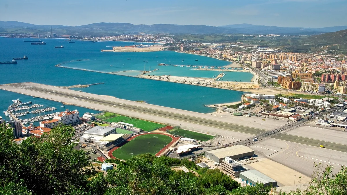
Few airports are as easy to recognise from the air as Gibraltar. A single runway runs east to west across the narrow isthmus, with its western end pushed out into the bay. Immediately south of it rises the Rock, and immediately north of it is the border with Spain. For more than eighty years the main road into Gibraltar ran straight across the runway, and traffic stopped every time an aircraft landed or took off.
The Royal Air Force, which runs the airfield as RAF Gibraltar, sums it up in a few lines: a 6,000 ft runway with about a third of it projecting into the sea, prohibited Spanish airspace immediately to the north, and "the 1,360 feet high Rock of Gibraltar only a quarter of a mile to the south". Under certain wind conditions, it adds, aircraft are not allowed to land at all because of the turbulence generated around the Rock.
This is a guide to that airport: how it came to be, why the road no longer crosses it, what the wind does there and what a private pilot needs to arrange before flying in.
From Racecourse to Wartime Airfield
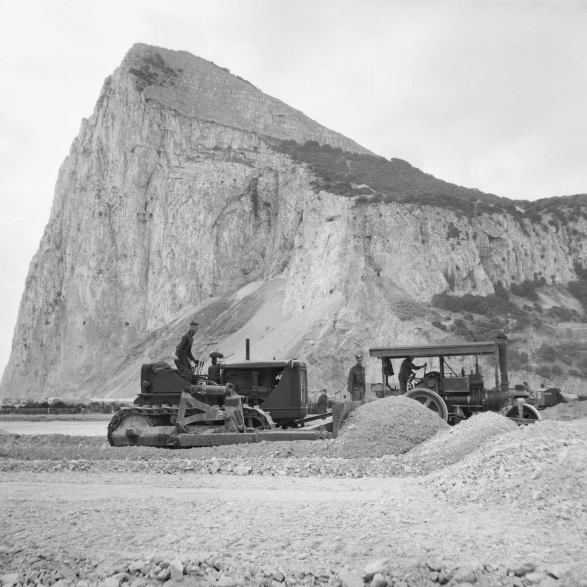
The airfield sits on Gibraltar's old horse-racing track, a detail the airport itself points out on its visitor page, which also notes that the RAF station was first known as RAF North Front when it opened in 1942. The Government of Gibraltar dates the runway to 1941, when it was built across Winston Churchill Avenue, the only road between Gibraltar and Spain.
During the Second World War the runway was lengthened westwards into the bay on reclaimed land, using rock blasted out while military tunnels were being dug inside the Rock. According to the history magazine After the Battle, as summarised in the airport's Wikipedia article, it went from about 1,150 yards in April 1942 to about 1,800 yards by July 1943, long enough for larger aircraft.
The wartime airfield was also the scene of the best-known accident in its history. On 4 July 1943 an RAF Liberator carrying General Władysław Sikorski, prime minister of the Polish government-in-exile, crashed into the sea seconds after taking off from Gibraltar. Sixteen of the seventeen people on board died; only the pilot survived. He later said the controls had jammed shortly after lift-off. The crash was ruled an accident, a conclusion that has been disputed ever since.
The Road That Crossed the Runway
For decades, the defining image of Gibraltar Airport was a set of barriers and traffic lights on Winston Churchill Avenue. Cars, buses, scooters and pedestrians waited at the edge of the runway while an airliner landed, then crossed the tarmac once it had cleared. In recent years, the Government of Gibraltar says, the road was closed more than 15 times a day for flights.
That ended at one minute past midnight on 31 March 2023, when Kingsway opened. The new road is about 1.2 km long, including about 350 metres of covered tunnel, and it lets traffic flow without stopping for aircraft for the first time since 1941. Cars, motorcycles and lorries no longer cross the runway. Pedestrians, cyclists and e-scooter riders still can, and the airport's visitor page treats it as one of Gibraltar's attractions, with some practical advice: follow the police officers' directions, stay in your lane, don't linger for photos and close your pockets so nothing blows out onto an active runway.
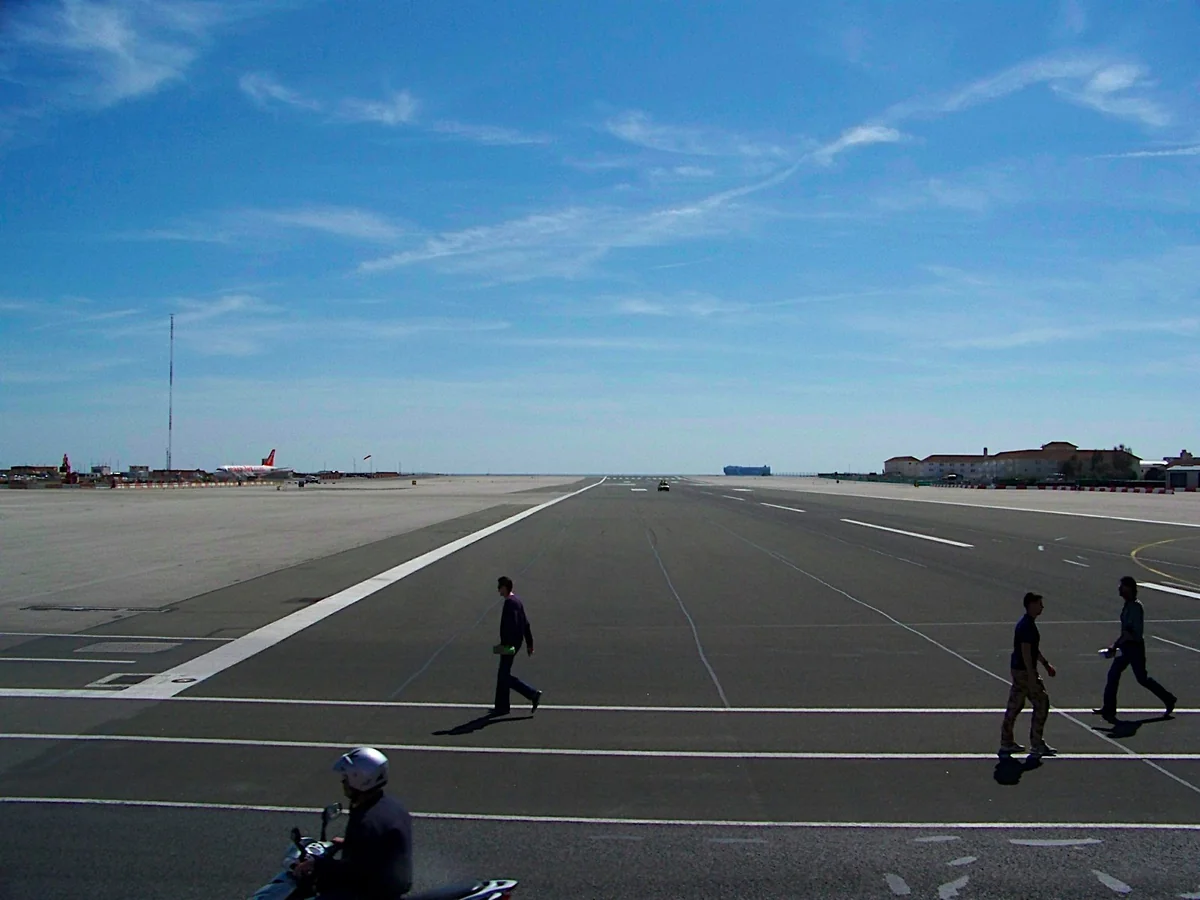
The same page suggests that visitors "of a certain age" might want to recreate the famous wedding photo of John Lennon and Yoko Ono, who married in Gibraltar in 1969, while reminding them that the spot is on an active runway.
The Rock and the Wind
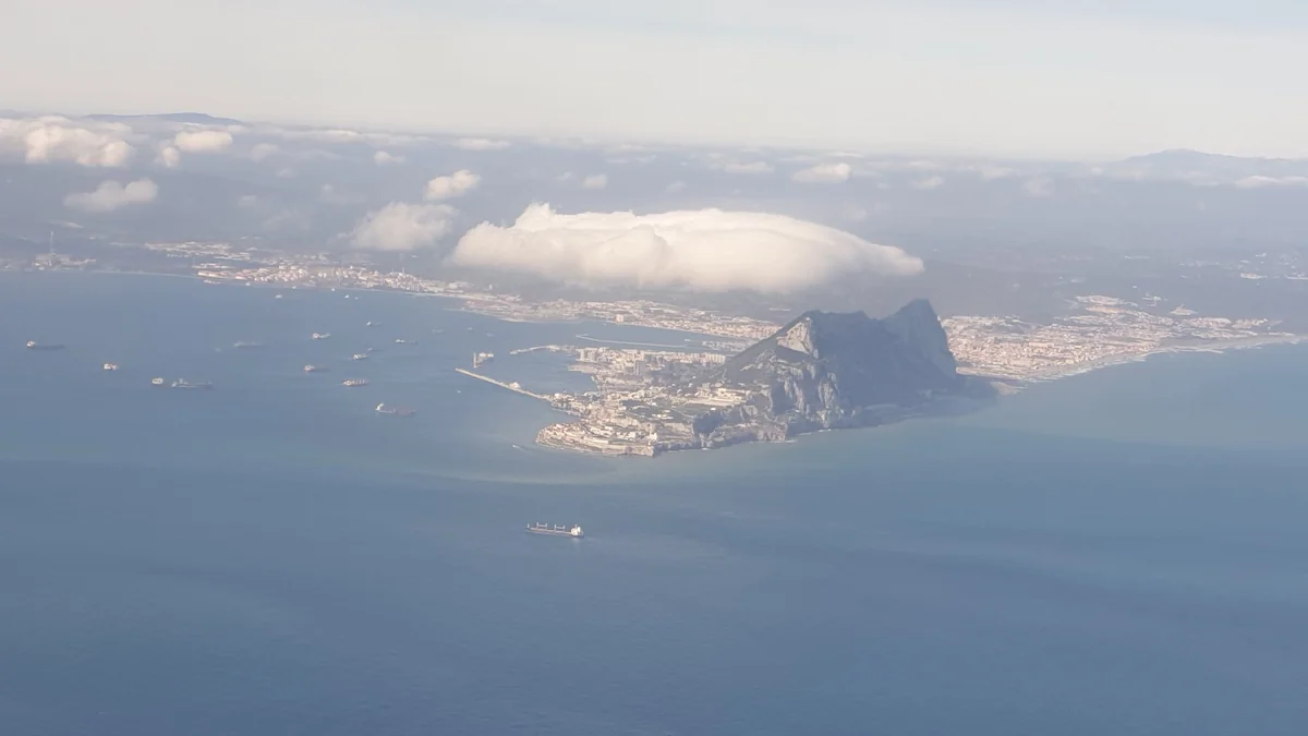
The Rock is what makes flying into Gibraltar interesting. It sits right in the path of the wind, and the airflow behind it can be rough.
The aerodrome pages of the UK Military AIP for Gibraltar (LXGB) are blunt about it. When the wind is between 110° and 250° and stronger than 15 kt, pilots should expect significant turbulence during the approach and the final stages of flight in the lee of the Rock, and that turbulence "can make landing dangerous or impossible". The AIP publishes a table of wind speeds above which turbulence or wind shear is likely on final approach. The threshold is lowest with the wind from the south, 11 kt from 180° magnetic, and it rises to 27 kt from 110° and 21 kt from 250°. The AIP also warns that turbulence and gusts can often be seen on the surface of the water, and that south-westerly winds above 25 kt can produce waterspouts on the approach to runway 27.
Easterly winds bring a different picture. The Levante, or Levanter as it is called in Gibraltar, blows through the Strait when pressure is higher over the Mediterranean than over the Atlantic. SKYbrary describes winds of 20 to 40 kt in and to the west of the Strait and the banner cloud that often streams west from the top of the Rock in a turbulent plume over the town. We covered how the Levante and Poniente form, and what they mean for light aircraft, in our guide to the Strait winds.
The AIP figures make no distinction between aircraft types: they apply to airliners and military jets alike. A light single will feel the same gusts more, and it has far less margin when the airspeed drops suddenly on short final. In practice, the AIP figures are a hard ceiling for a light aircraft, not a target. Check the forecast wind at the surface and aloft, know your own crosswind and gust limits (our crosswind landing guide covers how to set one), and carry enough fuel and a planned alternate to make turning away an easy decision.
Flying in as a Visiting Private Pilot
Gibraltar is open to general aviation. The airport's recreational flying page says it welcomes all types of recreational flying and pitches the airfield as a stop-off point for flights to Africa or around the western Mediterranean. It is still a military airfield, though, and the paperwork reflects that.
- Prior permission (PPR) is mandatory. Civil aircraft request it through the ground handling agent, GibAir (handling@gibair.gi), and must receive an acceptance before flying. The Gibraltar AIP (GEN, Issue 3) asks non-scheduled flights arriving from EU countries to submit the PPR form 24 hours before the requested arrival time, while the UK Military AIP sets a minimum of 4 hours. Apply early and use the longer figure.
- No separate permit for private flights. The Gibraltar AIP says private, non-commercial flights do not need permission from the Gibraltar Civil Aviation Authority. Commercial flights by foreign operators do.
- Opening hours. The UK Military AIP lists the aerodrome as open from 0800 to 2345 local time every day, with out-of-hours operations on request, and closed to all aircraft on 25 December.
- Follow the published entry routes. Aircraft crossing into or out of Gibraltar may only do so along the approaches published in the LXGB pages of the UK Military AIP or as instructed by ATC. The AIP also prohibits overflight of the Rock and the harbour installations. With prohibited airspace immediately to the north, this is not the place to improvise.
- Carry the documents. The Gibraltar AIP lists what pilots of private flights should be able to show: pilot licence, radio licence and medical certificate, certificate of registration, certificate of airworthiness, insurance, journey log, a copy of the filed flight plan with the relevant MET and NOTAMs, and charts for the route. Our preflight briefing checklist covers the MET and NOTAM side.
- Passports. Pilots of private flights must present their passengers to the Immigration Officer on arrival and on departure.
New Border Checks Since July 2026
Border procedures changed in July 2026. The UK–EU agreement on Gibraltar was signed on 14 July 2026 and has been provisionally applied since 15 July 2026. The treaty states that it is without prejudice to the UK's and Spain's positions on sovereignty. Under it, routine immigration checks have moved from the land border to the airport (and, where needed, the port). According to the UK government's travel advice, arrivals at the airport (officially Joshua Hassan Gibraltar International Airport since July 2026) now go through two sets of checks: Gibraltar immigration control by the Gibraltar authorities and Schengen entry control by the Spanish authorities. Once through, travellers can cross freely into Spain. Certain goods must also be declared to customs on arrival.
The official pages we checked describe these checks for airline passengers and do not spell out the procedure for a private aircraft arriving from Spain or Morocco. Ask GibAir how it applies to your flight when you request the PPR, and allow extra time on the ground.
Before You Go: A Short Checklist
- Request the PPR from GibAir well in advance and wait for the acceptance.
- Read the current LXGB pages of the UK Military AIP, including the entry routes and the turbulence chart, and check NOTAMs.
- Compare the forecast wind with the AIP turbulence table and with your own limits. If the Levanter cloud is on the Rock, or the wind is southerly and fresh, expect a rough final.
- Plan an alternate and the fuel to reach it.
- Have passports for everyone on board and the aircraft and pilot documents listed in the Gibraltar AIP.
- Ask the handling agent about immigration, customs and parking for light aircraft.
Gibraltar is small and unusual, and well worth the effort. Not many airfields let you land beside a 1,360 ft rock, then walk out of the terminal and across the runway you have just used.
Sources
- Royal Air Force, RAF Gibraltar station page
- UK Military AIP, AD 2 LXGB Gibraltar (operational hours, PPR, turbulence and wind shear); also listed on the RAF Gibraltar flying information page
- Gibraltar Civil Aviation Authority, Gibraltar AIP GEN, Issue 3 (31 March 2026)
- HM Government of Gibraltar, "Airport Tunnel to open on 31st March 2023", 28 March 2023
- HM Government of Gibraltar, "Kingsway inaugurated", 30 March 2023
- Gibraltar International Airport, Crossing the Runway and Recreational Flying
- SKYbrary, Levant Wind
- House of Lords Library, "UK-EU Agreement in respect of Gibraltar"
- GOV.UK, Gibraltar travel advice: entry requirements
- Wikipedia, Gibraltar International Airport (wartime runway extensions, citing After the Battle No. 21, 1978) and 1943 Gibraltar B-24 crash
This article is general information, not an operational briefing. Procedures at Gibraltar change: always check the current AIP, NOTAMs and the handling agent's requirements before you fly.
Cover: Gibraltar's runway seen from the Rock in 2009, when Winston Churchill Avenue still carried traffic across it. Photo by Andrew Griffith, Wikimedia Commons, CC BY 2.0 (cropped).
