The FAA's own Aviation Weather Handbook admits that most briefing services and apps now decode METARs for you. Then it adds the important part: pilots still need to know how to read the raw code, "in case the source does not provide a decoded version."
I'd add a second reason. A decoder tells you what the report says. Reading the code yourself is how you start noticing what it means for your flight: the dewpoint creeping up to the temperature, the TEMPO line hiding behind a nice headline, the time stamp that's two hours old.
This guide uses real reports from the morning of 12 October 2026, from Málaga, Madrid, London Heathrow and New York JFK. The format comes from ICAO and the World Meteorological Organization, so a METAR from Málaga and one from Manchester read almost the same. The United States is the main exception, and I'll point out where it differs.
METAR vs TAF: what's the difference?
A METAR tells you what the weather is at an aerodrome now; a TAF tells you what it is expected to be over the next 24 or 30 hours.
| METAR | TAF | |
|---|---|---|
| Type | Observation | Forecast |
| How often | Every 30 minutes (e.g. Málaga) or hourly (most US airports), plus SPECI | Four times a day |
| Period | A moment in time | Usually 24 or 30 hours (9 hours at some UK aerodromes) |
| Change groups | NOSIG / trend | FM, BECMG, TEMPO, PROB30/40 |
| Covers | The aerodrome | The aerodrome and its immediate surroundings |
A METAR is an observation. It tells you what the weather was at the aerodrome at a given moment. Málaga issues one every 30 minutes; most US airports issue one near the top of every hour. When something changes significantly between routine reports, you may see a SPECI, a special report in the same format.
A TAF (Terminal Aerodrome Forecast) is a forecast for the aerodrome itself, usually covering 24 or 30 hours and issued four times a day. The UK Met Office also issues shorter 9-hour TAFs for some aerodromes. Every time in both is UTC, marked with a Z.
Use them together: read the METAR against the TAF.
Decoding a METAR, group by group
Here is Málaga at 0800Z:
METAR LEMG 120800Z 29005KT 9999 FEW007 18/13 Q1017 NOSIGStation and time: LEMG 120800Z
LEMG is the ICAO code for Málaga-Costa del Sol. 120800Z means the 12th of the month at 0800 UTC, which was 10:00 local time in Spain that day. Check the time before anything else. A perfect METAR from three hours ago is not the weather now.
Wind: 29005KT
Wind from 290 degrees at 5 knots. The direction is where the wind blows from, and in a METAR it is given in degrees true. ATIS and the tower give it in magnetic, like the runways. Other forms you'll see:
- 31015G27KT: 310 degrees at 15 knots, gusting 27. The Met Office only reports a gust when it is at least 10 knots above the mean.
- VRB01KT: variable at 1 knot. Madrid-Barajas reported exactly that at 0800Z.
- 36003KT 340V040: from 360 degrees at 3 knots, but varying between 340 and 040. That was Madrid at 0700Z.
- 00000KT: calm.
Visibility: 9999
Visibility is in metres. 9999 means 10 km or more, and 0000 means less than 50 m. A second group with a compass point, such as 1200SW, gives the minimum visibility in that direction when it's much worse than the rest. Runway visual range appears as R27R/1100: 1,100 m on runway 27R. In the US, visibility is in statute miles, so you'll see 10SM instead.
Present weather: -RA, +SHRA, BR
Málaga had nothing to report, so the group is simply missing. The codes are short and combine like building blocks:
- Intensity: - light, no sign moderate, + heavy.
- Descriptors: SH showers, TS thunderstorm, FZ freezing, BL blowing, MI shallow.
- Phenomena: RA rain, DZ drizzle, SN snow, GR hail, BR mist, FG fog, HZ haze.
- VC means in the vicinity rather than at the station (in the US, 5 to 10 statute miles away). RE means recent, so RETS is a thunderstorm since the previous report.
So +TSRA is a thunderstorm with heavy rain, and -FZDZ is light freezing drizzle, which is a very good reason to stay on the ground.
Cloud: FEW007
Cloud amount is given in oktas, eighths of the sky: FEW is 1 to 2, SCT (scattered) 3 to 4, BKN (broken) 5 to 7 and OVC (overcast) 8. The three digits are the base in hundreds of feet above the aerodrome, not above sea level. FEW007 is a few clouds at 700 ft.
Only two cloud types are ever named: CB (cumulonimbus) and TCU (towering cumulus), as in BKN010CB. The ceiling is the lowest layer reported as broken or overcast. You may also see NSC (no significant cloud: nothing below 5,000 ft and no CB or TCU), NCD (no cloud detected, automatic reports only) and VV (vertical visibility, when the sky is obscured).
CAVOK
Pronounced "cav-oh-kay", it replaces visibility, weather and cloud when all of these are true: visibility 10 km or more, no cloud below 5,000 ft or the highest minimum sector altitude (whichever is greater), no CB or TCU, and no significant weather.
Note what it doesn't say. There can be cloud above that level, and it describes one moment. Málaga reported CAVOK at 0600Z. At 0630Z it reported FEW006. Within half an hour, a few low clouds had appeared at 600 ft.
Temperature and dewpoint: 18/13
18°C, dewpoint 13°C. An M means minus, so 03/M01 is 3°C with a dewpoint of -1°C. The useful number is the spread between them. At 0530Z Málaga was 15/13, a spread of only 2°C. A small spread means humid air: think mist or fog, especially with light wind as the ground cools, and think about carb icing, even on warm days.
Pressure: Q1017
QNH 1017 hPa. If the group starts with A, as in the US, it's inches of mercury: A2975 is 29.75 inHg.
Trend: NOSIG
Some METARs end with a short forecast for the two hours after the observation. NOSIG means no significant change is expected. Instead you may see BECMG or TEMPO followed by the expected change, which work the same way as in a TAF.
The American version
METAR KJFK 120751Z 02009KT 10SM BKN010 OVC021 13/11 A2975 RMK AO2 SLP072 T01280111 $Same skeleton, different units. Wind 020 degrees at 9 knots, visibility 10 statute miles, broken at 1,000 ft (that's the ceiling), overcast at 2,100 ft, 13/11, altimeter 29.75 inHg. Then come the remarks after RMK:
- AO2: an automated station with a precipitation discriminator.
- SLP072: sea-level pressure 1007.2 hPa (the leading 10 is left out).
- T01280111: temperature 12.8°C and dewpoint 11.1°C, to the tenth of a degree.
- $: the system has detected that it needs maintenance.
In the FAA's flight categories, a 1,000 ft ceiling is the bottom edge of marginal VFR (MVFR). Anything lower is IFR.
A word on AUTO reports
METAR EGLL 120720Z AUTO 12009KT 9999 -RA NCD 14/12 Q1013AUTO means no human observer was involved. This Heathrow report shows light rain with no cloud detected, while the TAF for the same morning forecast a broken layer at 2,500 ft. The Met Office warns that visibility, weather and cloud from automated systems "should be treated with caution" because of the limits of the sensors and the small area they sample. Read AUTO reports as useful data, not as gospel.
Reading a TAF
Here is the Málaga TAF issued that morning:
TAF LEMG 120500Z 1206/1306 29004KT CAVOK TX28/1213Z TN16/1206Z
      BECMG 1209/1211 13010KT
BECMG 1217/1219 VRB03KT- 120500Z: issued on the 12th at 0500 UTC.
- 1206/1306: valid from the 12th at 0600Z to the 13th at 0600Z.
- 29004KT CAVOK: the starting conditions. Light north-westerly, CAVOK.
- TX28/1213Z TN16/1206Z: maximum temperature 28°C around 1300Z, minimum 16°C around 0600Z. US TAFs from the National Weather Service don't include temperatures.
- BECMG 1209/1211 13010KT: at some point between 0900Z and 1100Z the wind becomes 130 degrees at 10 knots, and stays that way.
- BECMG 1217/1219 VRB03KT: in the early evening it drops to light and variable.
Those two directions are no accident. AEMET's aerodrome guide for Málaga notes that, because the Guadalhorce valley runs north-west to south-east, the two most typical wind regimes at the airport blow along it (more in our guide to Levante and Poniente). A 130-degree wind also lines up almost exactly with runway 13.
Also notice that the 0630Z METAR showed FEW006 while the TAF said CAVOK. That doesn't make the TAF wrong. The Met Office explains that TAF values describe the most likely conditions within ranges defined by ICAO. A forecast is a best estimate, not a contract.
The change groups
Most of the skill in reading a TAF is in these four:
- FM (from): a complete new set of conditions from that time on. FM121500 in the JFK TAF means everything before it is replaced from 1500Z on the 12th.
- BECMG (becoming): a change that happens sometime within the window and then lasts.
- TEMPO (temporarily): fluctuations that, in the FAA's definition, are more likely than not, last an hour or less each time and add up to less than half of the period.
- PROB30 / PROB40: a 30% or 40% chance. Outside the US they're often combined with TEMPO. The US National Weather Service only uses PROB30.
The Heathrow TAF that morning had a good example near the end:
PROB30 TEMPO 1308/1312 27015G28KT 3000 +RARead it as: a 30% chance that, at times between 0800Z and 1200Z on the 13th, the wind will be 270 degrees at 15 knots gusting 28, with visibility down to 3,000 m in heavy rain. For a light aircraft, that one line matters more than the headline.
Watch out for TAF AMD, an amended forecast. It replaces the previous TAF straight away, so always make sure you're reading the latest one.
A habit that works
- Times first. Check when the METAR was observed and when the TAF was issued and is valid. Convert to local time if that's how you think about your flight.
- Read the METAR against the TAF. If the weather now is already worse than the forecast said it would be, trust the forecast less for the rest of the day.
- Plan for the TEMPO and PROB lines. Ask whether you could cope if they happened during your arrival, and what you'd do if you couldn't: usually an alternate, with the fuel to reach it. Our Planner helps you set both up before you go.
- Look at the spread and the wind. A shrinking temperature and dewpoint spread and a gust group tell you a lot in a few characters.
- Remember the area it covers. A TAF covers the aerodrome and its immediate surroundings (within 5 statute miles in the US). It says nothing about the ridge or the coast halfway along your route. Use area forecasts and charts for that.
Our Briefing tool can load the departure weather and uses the TAF to forecast temperatures for its performance figures. It's a help with the numbers, not a replacement for reading the reports yourself.
FAQ
What's the difference between a METAR and a TAF?
A METAR tells you what the weather is at an aerodrome now; a TAF tells you what it is expected to be over the next 24 or 30 hours.
What does CAVOK mean?
Ceiling and visibility OK: visibility 10 km or more, no cloud below 5,000 ft or the highest minimum sector altitude (whichever is greater), no CB or TCU, and no significant weather. US domestic TAFs don't use it.
Is the wind in a METAR true or magnetic?
True. ATIS broadcasts and controllers give the wind in magnetic, to match the runways.
What's the difference between BECMG and TEMPO?
BECMG is a lasting change that happens within the time window. TEMPO is a temporary fluctuation that comes and goes, each spell lasting an hour or less.
What does 9999 mean in a METAR?
Visibility of 10 km or more. 0000 means less than 50 m.
Are cloud heights above sea level?
No. In a METAR and TAF they are in hundreds of feet above the aerodrome. BKN015 is a broken layer 1,500 ft above the field.
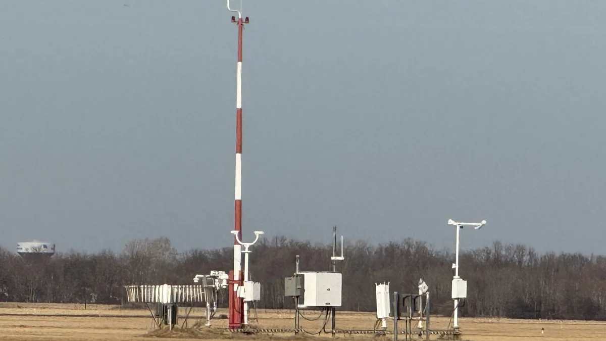
Cover: the Automated Surface Observing System (ASOS) at Northeast Philadelphia Airport, the kind of sensors behind an automated METAR. Photo: Famartin, Wikimedia Commons, licensed CC BY-SA 4.0, cropped.
Sources
- FAA, Aviation Weather Handbook (FAA-H-8083-28B), chapters 24 (METAR/SPECI) and 27 (TAF)
- Met Office, GetMet: METAR and TAF decodes (PDF)
- Met Office, MAVIS user guide: How to decode a TAF
- Met Office, METARs and TAFs
- NOAA Aviation Weather Center, METAR and TAF data (reports quoted here retrieved on 12 October 2026)
